UN Backs Replacing Mercator With New World Map
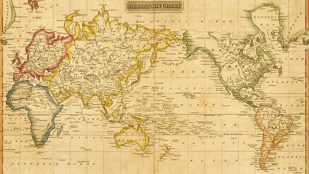

The Facts
- The U.N. General Assembly adopted an African-backed resolution Friday encouraging governments, schools, international organizations and tech companies to use the Equal Earth map projection, which preserves countries' relative sizes, and other equal-area maps in place of the Mercator projection. The vote was 164-1, with six abstentions.
- The Mercator projection, created by Flemish cartographer Gerardus Mercator in 1569 primarily for navigation, distorts the relative size of landmasses by enlarging regions farther from the equator — making Africa appear roughly the same size as Greenland, despite being about 14 times larger.
- The Equal Earth projection, developed in 2018 by cartographers Bojan Šavrič, Tom Patterson and Bernhard Jenny, is an equal-area world map that preserves the relative size of countries and landmasses while using curved outer edges to suggest Earth's spherical form and reduce visual distortion.


Sources Split
LEFT
CENTER
RIGHT
+1

+1
+1

+1
ESTAB
CRIT
CENTER
PRO
ESTAB
The Spin
Pro-establishment narrative
Scrapping the Mercator projection risks turning a cartographic choice into a political statement. Every flat map distorts the globe, and Mercator remains useful because it preserves angles and directions, especially for navigation. Equal Earth represents land area more accurately but introduces other distortions. Governments and schools should teach the strengths and limits of different projections rather than declaring one map unacceptable and replacing it by decree.
Establishment-critical narrative
Replacing the Mercator projection is a long-overdue correction to a centuries-old distortion that makes Africa appear smaller than it really is. Maps shape how generations understand the world, and using a projection that exaggerates northern landmasses reinforces an outdated view of Africa's place in it. A U.N. vote for a more accurate representation is a meaningful step toward putting global geography — and Africa's true scale — back into perspective.
