The South China Sea Conflict


Overview
- The South China Sea is a large semi-enclosed western Pacific sea that connects the Malacca-Singapore route to the Taiwan Strait, carries about one-third of global shipping and is central to Asian energy trade, fisheries and supply chains.
- Historical claims are layered rather than uniform: Chinese records and government mapmaking led to the U-shaped line, Vietnamese sources cite the Nguyen-era administration and later claimants inherited colonial-era boundaries from French, Spanish-American and British rule.
- The 2016 Annex VII tribunal in Philippines vs. China rejected the legal basis for historic-rights claims within the nine-dash line, limited the maritime entitlements of key features and did not decide sovereignty over land territory.


Sources Split
LEFT
CENTER
RIGHT


+6
+2
+5

+1
+10


+2

+1

+3

ESTAB
CRIT
CENTER
PRO
ESTAB
The Spin
Anti-China narrative
China's expansion in the South China Sea is a deliberate campaign to take over disputed waters. Artificial islands, coast guard pressure, fishing fleets and naval growth work together to intimidate smaller neighbors and weaken open access. Legal rulings mean little without the power to enforce them. A stronger allied presence keeps the sea from becoming a Chinese lake and gives Southeast Asian states room to resist coercion.


Pro-China narrative
China is defending long-standing territorial claims against a U.S.-backed effort to turn a regional dispute international. Outside arbitration and freedom-of-navigation patrols turn a manageable neighborhood problem into a great-power confrontation. The loudest talk about rules masks a drive to contain China near its own coast. Stability comes from direct diplomacy among claimant states, not foreign warships performing legal theater.


Establishment-critical narrative
The South China Sea has become a convenient stage for Washington, Beijing, the media and defense experts to sell a permanent crisis. Every reef incident becomes proof of a grand showdown, while ordinary diplomacy gets treated as weakness. However, Southeast Asian claimants are not props in a U.S.-China contest. Fishermen, coast guards, energy projects and national sovereignty are on the line for countries living under daily pressure. The core issue is whether smaller nations can maintain their rights in their own waters.


Geography and Stakes
Stretching across a vast area and bordering several states, the South China Sea supports millions of livelihoods and carries substantial global trade and energy flows. These overlapping interests make it economically, environmentally and strategically significant.
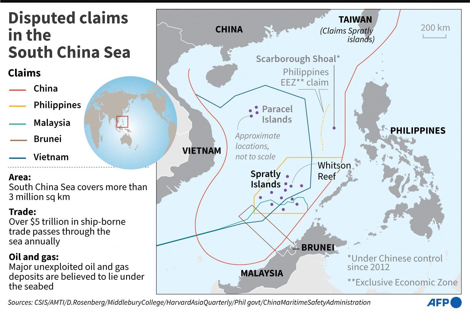
The South China Sea covers about 3.5 million square kilometers, or roughly 1.3 million square miles, making it a large semi-enclosed arm of the western Pacific rather than a narrow local waterway. It runs from the Singapore and Malacca Strait area in the southwest to the Taiwan Strait in the northeast, linking the Indian Ocean approach to East Asian seas.
Its coastlines and approaches touch or face China, Taiwan, the Philippines, Vietnam, Malaysia, Brunei, Indonesia, Singapore and the Gulf of Thailand, which explains why many states depend on it even before sovereignty claims are considered. The sea contains scattered archipelagos, reefs, rocks, banks and shoals, including the Paracels, Spratlys, Pratas, Macclesfield Bank and Scarborough Shoal, many of which sit far from major coastlines but close to major shipping and fishing grounds.
Shipping Arteries and Chokepoints
Trillions of dollars in goods move through the South China Sea each year, making it one of the world's most consequential maritime corridors. The Center for Strategic and International Studies (CSIS) estimates that the South China Sea carries about one-third of global shipping, and the route is especially important for China, Taiwan, Japan and South Korea. The 900-kilometer Malacca Strait is the shortest sea route from East Asia to the Middle East and Europe, and it connects Indian Ocean energy flows to the South China Sea's northeast-bound shipping lanes.
More than 30% of global maritime trade, worth more than $3.5 trillion annually, passes through the South China Sea. In 2023, 34% of global LNG trade, about 6.7 trillion cubic feet, passed through the South China Sea, including flows from Qatar, Malaysia, Oman, Brunei and the UAE to Asian buyers.
Fisheries and Coastal Livelihoods
The South China Sea is among the world's top five fishing zones and accounts for about 12% of global fish catch. More than half of the world's fishing vessels operate in these waters, and CSIS estimated that fisheries there officially employ around 3.7 million people, with many more linked to informal or illegal, unreported and unregulated fishing. Stocks have declined by 70% to 95% since the 1950s, and catch rates have fallen by 66% to 75% over the last 20 years.
This makes the sea not only a strategic corridor but also a food-security zone for coastal communities in the Philippines, Vietnam, China, Malaysia, Brunei and Indonesia. Public debate often reduces resource competition to oil and shipping, even though fisheries are a more immediate livelihood issue for many communities.
Oil and Gas Beneath the Margins
The U.S. Energy Information Administration estimates that the South China Sea holds about 190 trillion cubic feet of natural gas and 11 billion barrels of oil in proved and probable reserves. The U.S. Geological Survey estimated in 2012 that the sea could contain another 160 trillion cubic feet of gas and 12 billion barrels of oil undiscovered. The Asia Maritime Transparency Initiative (AMTI) notes that many reserves lie along the continental margins rather than directly beneath the disputed rocks and reefs, which means conflict often arises where claimed maritime zones overlap offshore blocks.
Malaysia, Vietnam, the Philippines, Brunei and Indonesia have economic reasons to develop offshore resources near their coasts, while China views resource activity inside its claimed line as connected to sovereignty and jurisdiction. As a result, the sea's value comes from a combination of transit, fisheries, hydrocarbons and military geography rather than any single resource.
Sources:


The Spin
Anti-China narrative
The South China Sea is too important to be ignored. It connects the Strait of Malacca to the Strait of Taiwan, carries massive volumes of petroleum and LNG, and anchors trillions in trade. Control over these waters means leverage over Asian economies and global supply chains. Freedom of navigation is not a slogan here. It is the minimum condition for keeping global commerce from being held hostage.


Pro-China narrative
The South China Sea is a vital maritime space connecting China with Southeast Asia, the Indian Ocean and global markets. Its shipping routes, fisheries and energy resources are important to regional development and China's economic security. China's presence in the waters protects legitimate national interests, safeguards trade routes and supports regional stability.

Establishment-critical narrative
The South China Sea has become a proving ground for empire management. A waterway carrying more than 30% of global maritime trade and a huge energy promise now serves as a stage for aircraft carriers, bases and elite panic over control. The geography matters because ordinary Asians live beside it, work in it and depend on it, while distant powers reduce it to a chessboard.


Narrative D
The obsession with ships, maps and hydrocarbons hides the more serious damage. The South China Sea is rich in fish and resources, yet conflict has turned it into a zone of ecological decline. Reefs, fisheries and coastal livelihoods are treated as collateral in a contest over energy and prestige. A sea that sustains millions is being sacrificed to militarized resource politics.


Historical Claims
Historical claims in the South China Sea reflect centuries of navigation, fishing, mapping and political activity by regional states.
Chinese and Vietnamese records offer competing interpretations of sovereignty, while colonial boundaries further shaped modern claims. The emergence of the U-shaped line and international maritime law transformed these historical narratives into today's complex territorial disputes.
Before the late 20th century, the South China Sea served fishermen from China and other littoral states, as well as regional and international navigation. This historical pattern matters because many pre-modern records describe use, sailing, fishing, naming or tribute rather than the modern legal idea of exclusive territorial sovereignty. Chinese sources and state-aligned accounts emphasize early discovery, naming, fishing and administrative activity by Chinese dynasties.
Chinese President Xi Jinping invoked Zheng He's voyages in a 2018 message to Filipinos, saying the Ming-era navigator visited Manila Bay, the Visayas and Sulu more than 600 years earlier, though Al Jazeera reported that some researchers have used Chinese records to challenge that specific claim.
The U-shaped Line and Modern Chinese Cartography
The Republic of China (ROC) first published the U-shaped line on an official map in 1948, and Chinese official and private mapmaking in the 1930s preceded that formal publication. ROC mapmaking in the 1930s helped fix James Shoal, or Zengmu Ansha, in Chinese geography texts as China's southernmost feature, even though James Shoal is a submerged bank near Malaysia rather than an above-water island.
The ROC line was reportedly an islands-attribution boundary rather than a clearly defined maritime-rights boundary, but later Chinese practice made it central to wider disputes over waters and resources. In 2009, after Vietnam and Malaysia filed a joint continental-shelf submission, China sent the U.N. a map with a U-shaped, or nine-dash, line, making the cartographic line central to contemporary legal diplomacy.
Vietnamese Imperial-era Evidence
Vietnamese sources describe Nguyen-era Hoang Sa fleets or state missions from the 17th century that exploited and administered the Paracels and related islands. Vietnamese researchers cite Nguyen dynasty maps and records, including the 1838 Dai Nam nhat thong toan do, for Hoang Sa and Van Ly Truong Sa.
Vietnamese sources describe state-backed efforts to collect maps, documents and foreign-language materials to support Hanoi's position, noting that Vietnamese leaders have often pursued a cautious approach toward litigation or open escalation with China. Chinese and pro-China sources contest Vietnamese and Philippine historical arguments, and present Chinese documentary and archaeological evidence as the stronger basis for sovereignty over the South China Sea.
Colonial Boundaries
France ruled Indochina from 1862 to 1954, drew a Tonkin Gulf boundary with China in 1887, and asserted sovereignty over the Paracels and Spratlys in the 1930s. The Philippines' treaty limits stem from Spain's 1898 cession to the United States, and Philippine territorial-sea claims based on those inherited limits have long been disputed in international law.
Malaysia and Brunei's claims derive from maritime zones off former British Borneo territories, and Malaysia claims seven Spratly islands or rocks while Brunei claims maritime areas but no occupied islands. These colonial inheritances show that today's disputes are not simply ancient quarrels carried forward unchanged, but a layered record of pre-modern use, nationalist cartography, colonial administration and post-independence maritime law.
UNCLOS and International Law
The South China Sea conflict revolves significantly around the interpretation and application of the U.N. Convention on the Law of the Sea (UNCLOS), which defines maritime zones, navigation rights and coastal-state entitlements at sea.
Under UNCLOS, coastal states may claim a territorial sea, an exclusive economic zone (EEZ) and a continental shelf if the relevant legal conditions are met. An exclusive economic zone gives a coastal state sovereign rights for resource exploration and exploitation but does not make the water column sovereign territory in the same way as land territory. These distinctions are central to the South China Sea because many disputes concern whether rocks, low-tide elevations or islands generate maritime entitlements.
The Philippines vs. China Arbitration
The Philippines initiated the South China Sea arbitration against China in January 2013 under Annex VII of the 1982 UNCLOS. On July 12, 2016, a unanimous Annex VII arbitral tribunal issued its award in Philippines vs. China, with the Permanent Court of Arbitration serving as registry rather than as the court deciding the case.
The tribunal examined historic rights, maritime entitlements, feature status and the lawfulness of certain Chinese actions under UNCLOS. The tribunal did not decide sovereignty over land territory or delimit national maritime boundaries, which is a limit frequently overlooked in public debate.
What the Tribunal Found
The tribunal found no legal basis for China's historic-rights claims within the nine-dash line under UNCLOS. It found that some disputed waters fell within the Philippines' EEZ because no Chinese maritime entitlement overlapped them. It also found that China violated the Philippines' sovereign rights in areas of its EEZ by interfering with fishing and petroleum activity and by other conduct addressed in the award.
Additionally, it concluded that Scarborough Shoal is a rock entitled only to a 12-nautical-mile territorial sea, not an EEZ, and that none of the Spratly features qualified as islands capable of generating an EEZ.
Rejection, Bindingness and Practical Weight
China refused to participate in the arbitration and later rejected the award, saying it was invalid, nonbinding and outside the tribunal's jurisdiction. Chinese state-aligned legal commentary argues that the case was a political proceeding rather than a valid legal process. Western governments describe the award as final and legally binding between China and the Philippines, but also acknowledge that UNCLOS has no direct enforcement police force.
China has not complied with core findings, and claimant states continue to face operational constraints at sea. On July 12, 2026, the U.S., the U.K. and 12 other Western and Asian countries reasserted that China's expansive claims in the South China Sea are illegal per the 2016 ruling. However, China reiterated that the ruling was "null and void and has no binding force" and Beijing "neither accepts nor recognizes it."
China's Claims and Strategy
China claims historical rights over nearly 90% of the South China Sea through its nine-dash line, and uses heavy pressure by deploying the Chinese Coast Guard and maritime militias to surround and crowd out rival ships from Vietnam and the Philippines.
Chinese maps showed a U-shaped South China Sea claim line in the late 1940s, with one account dating it to 1947 and another to a 1948 ROC official map. In 1952, Mao Zedong abandoned Chinese claims to the Gulf of Tonkin, and the dotted line lost two dashes, leaving the nine-dash line used in later Chinese maps. Beijing's position begins with claimed sovereignty over island groups and related features, though the line's legal meaning has often remained ambiguous.
Top Chinese diplomat Wang Yi has repeatedly rejected the suggestion that Beijing claims everything "within the dotted line" as its territorial waters, calling it "a deliberate attempt to confuse different concepts and distort China's position." "The South China Sea is one of the safest and freest maritime areas in the world where freedom of navigation has never been an issue," Wang said in July 2024.
Administrative Control Through Sansha
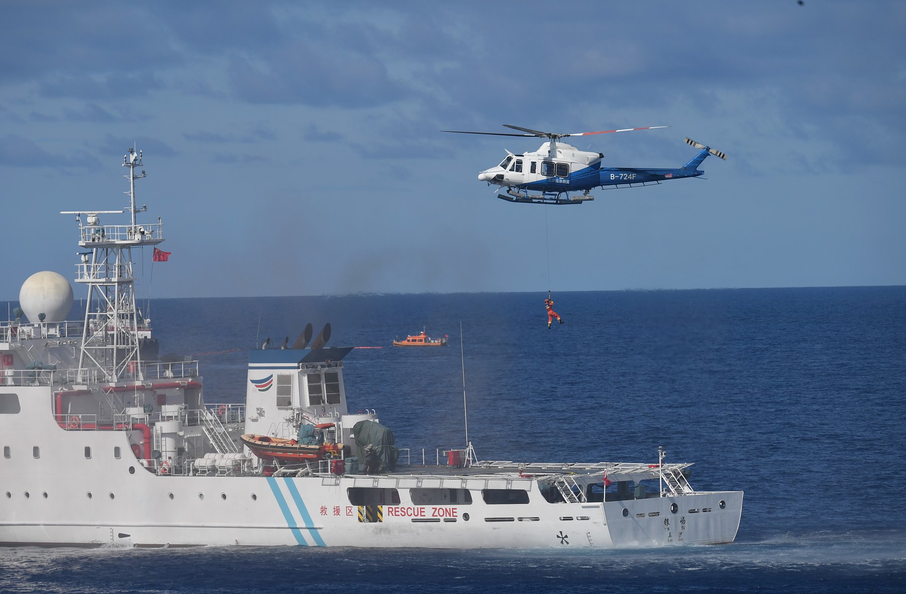
In late July 2012, Beijing established Sansha as a Hainan prefecture-level city to administer the Paracels, Spratlys and Macclesfield Bank. Sansha is headquartered on Woody Island and has been described as a mechanism for day-to-day administrative control, resource allocation, law enforcement coordination and military-civil fusion in the South China Sea.
On April 18, 2020, China's State Council announced two new districts in Sansha City, headquartered on Woody Island and governing most Chinese South China Sea claims. Radio Free Asia reported that Sansha acquired or planned to acquire hardware, equipment, software and materials from at least 25 U.S. and other foreign companies for surveillance, maritime law enforcement and information-security purposes.
"Eight years after China set Sansha as a city-level administrative unit, it is now time to subdivide it with different districts to further fulfill the responsibility of safeguarding our national sovereignty," Zhang Junshe, a senior research fellow at the People's Liberation Army Naval Military Studies Research Institute, told the Global Times.
Island-Building and Militarization
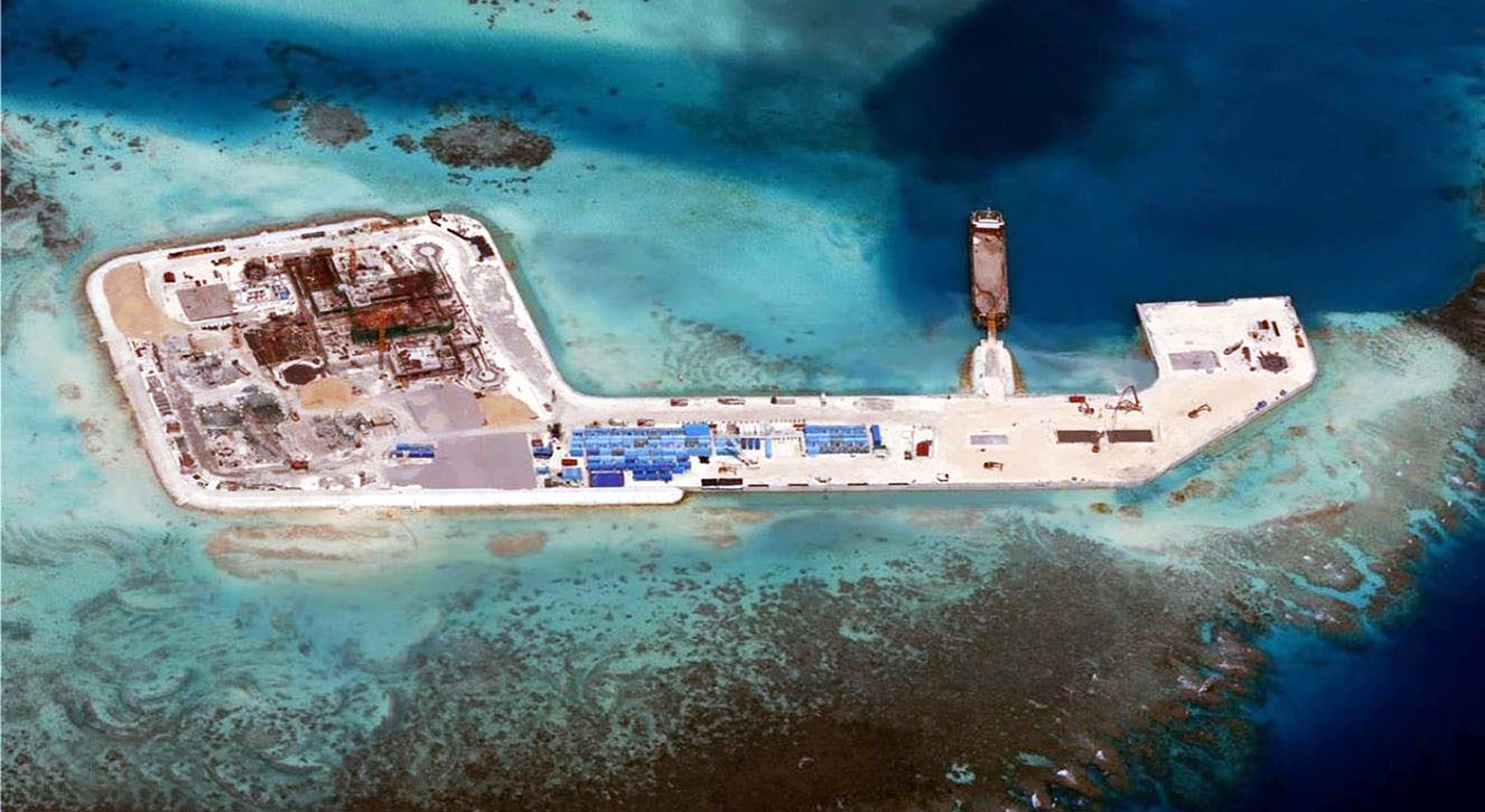
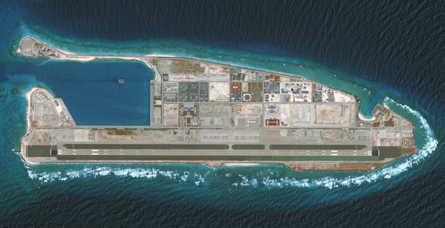
After completing artificial island outposts in the Spratlys in 2016, China expanded a maritime militia used with law enforcement and military vessels to assert control over peacetime activity. AMTI imagery updated June 29, 2017 showed missile shelters, radar and communications facilities being built at Fiery Cross, Mischief and Subi Reefs.
ABC reported in 2025 that China had built a 3,200-hectare network of South China Sea island military bases, some able to launch nuclear-capable bombers, and cited satellite imagery and AMTI analysis. Abdul Rahman Yaacob, a research fellow at Lowy's South East Asia Program, said the bases were "extremely concerning" for Australia.
"These are long 3,000-metre runways that China has built, clearly with the intent to deploy advanced H6K bombers. These bombers can launch missiles within range of Australia. Three of the bases in the Spratly island chain are now capable of landing those bombers, too," he told the ABC.
However, Chinese officials and state media have repeatedly described facilities and defensive deployments as legitimate measures to safeguard sovereignty.
Domestic Narrative and Historical Sovereignty
CGTN articles ground China's claims in first discovery, naming, development and long-term administration of South China Sea islands and waters. They claim that, after World War II, Vietnam, the Philippines and some other neighboring states did not formally challenge China's claims to sovereignty over certain South China Sea islands or the line depicted on Chinese maps. Chinese interpretations of historical documents and diplomatic records further argue that some states and international organizations acknowledged, or did not object to, these claims.
Academic research links the South China Sea to the Chinese geobody and to the Century of National Humiliation (a period of national subjugation and foreign intervention in China that lasted from 1839 to 1949), arguing that maritime claims have become connected to national identity and legitimacy. Chinese state-media narratives often portray Western, Philippine or allied criticism as selective, coercive or part of a broader information struggle.
The Other Claimants
The South China Sea involves multiple overlapping claims, as Vietnam, the Philippines, Malaysia, Brunei, Indonesia and Taiwan pursue different strategies to protect their maritime interests.
China and Vietnam currently dispute the Paracel and Spratly Islands, and China used force in 1988 to occupy Vietnam-controlled Johnson South Reef. Vietnam has pursued legal, diplomatic and physical measures while avoiding full alignment with any external power, a balancing approach often described as non-aligned or quiet but active.
AMTI reported Vietnam had created about 3,319 acres of artificial land in the Spratlys, roughly 70% to 71% of China's 4,650 acres, after starting its major campaign in 2021. Vietnam did not sign the July 12, 2026 joint statement by 14 countries marking the arbitration award's 10th anniversary and saying it invalidated China's expansive claims, which illustrates Hanoi's preference for calibrated signaling toward Beijing.
The Philippines Between Litigation and Accommodation
The Philippines filed arbitration in 2013, and on July 12, 2016, a Hague tribunal ruled for Manila against much of Beijing's nine-dash-line claim, while China rejected the outcome. Then President Rodrigo Duterte initially downplayed the award and sought closer ties with Beijing, but at the U.N. General Assembly in September 2020 he said the award was part of international law and beyond compromise.
The present President Ferdinand Marcos Jr. has moved toward a more public defense of Philippine maritime rights and closer security coordination with the United States and partners. On Nov. 8, 2024, Marcos signed the Maritime Zones Act and Archipelagic Sea Lanes Act, and said, "With these pieces of legislation, we align our domestic laws with international law, specifically the UN (United Nations) Convention on the Law of the Sea or UNCLOS to improve our capacity for governance and reinforce our maritime policies for economic development and for national security."
Beijing responded on Nov. 10 with baselines around Scarborough Shoal. The Philippines rejected China's declaration as a violation of its "long-established sovereignty over the shoal."
Malaysia, Brunei and Indonesia
Brunei first asserted rights to a South China Sea area shortly after independence in 1984 and claims no islands, while Malaysia claims only a few Spratly islands. Malaysia has generally pursued a quieter approach than the Philippines or Vietnam, but after a leaked Chinese letter urged Malaysia to halt oil and gas work near Luconia Shoals, Prime Minister Anwar Ibrahim said Malaysia would continue extracting resources.
Indonesia claims no Spratly or Paracel islands and no state claims the Natunas, but Chinese fishing and coast guard vessels have operated without permission in its Natuna EEZ. Indonesian analysts and officials often distinguish sovereignty over the Natunas from maritime-rights disputes caused by overlap between Indonesia's EEZ and China's line-based assertions.
Taiwan's Overlapping Inheritance
China says its nine-dash line descends from the ROC U-shaped map issued in 1948, which makes Taiwan's South China Sea posture unusually complex. Taiwan disputes the Spratlys with Vietnam, the Philippines, Malaysia and Brunei, and disputes the Paracels with Vietnam.
On July 23, 2026, at a legislative committee meeting on the nation's South China Sea policy, held in conjunction with the 10th anniversary of the Permanent Court of Arbitration ruling on the sea, Taiwan's Minister of Foreign Affairs Lin Chia-lung said, "Taiwan has a legitimate claim to the South China Sea islands."
However, Taiwan's own disputed international status complicates its ability to clarify or adjust inherited ROC claims without affecting domestic politics, cross-strait relations and ties with the United States.
Militarization and Strategy
In the South China Sea, China combines artificial-island construction, military outposts, surveillance systems and maritime forces to protect its sovereignty, security and navigation.
By July 2015, China had built seven new islets in the South China Sea and added ports, military buildings and one airstrip, while working on two more airstrips. In December 2016, China appeared to have placed anti-aircraft and anti-missile weapons on all seven artificial islands it built.
China also reportedly built point-defense sites, including large anti-aircraft guns and probable close-in weapons systems, at each Spratly outpost. In March 2022, a U.S. admiral said China had equipped at least three built islands with missiles, jamming gear, lasers and fighter jets.
Sensors, Electronic Warfare and A2/AD Logic
A 2025 AMTI analysis of satellite imagery identified newly constructed and upgraded radar facilities, antenna arrays and reinforced electronic-warfare infrastructure at China's three major outposts in the Spratlys: Mischief, Subi and Fiery Cross Reefs.
"These upgrades underscore the fact that a major function of China's bases is to provide unparalleled ISR (intelligence, surveillance, and reconnaissance) coverage of the South China Sea, supporting the operations of China's coast guard and navy in peacetime and allowing Beijing to contest the use of the electromagnetic spectrum by others in the event of a conflict," the report said.
Pacific Forum's February 2025 working paper treated the South China Sea as a PLA operational focus and cataloged Chinese anti-access and area-denial capabilities there. The strategic logic is not only to place weapons on reefs but to create a network of runways, ports, radars, communications nodes and patrol forces that can monitor and contest movement through the sea.
Coast Guard and Maritime Militia
Philippine authorities accused Chinese maritime militia boats of assisting the China Coast Guard against resupply missions to Second Thomas Shoal. RAND said China's armed fishing militia, called the People's Armed Forces Maritime Militia by the U.S. Defense Department, is government-supported, under PLA command and used with CCG and PLAN operations.
According to an AMTI report, Chinese maritime militia deployments averaged 241 vessels per day in 2025, the highest annual level recorded, compared with an average of 232 vessels per day in 2024. The fleet included both professional militia personnel and civilian members of the state-subsidized "Spratly Backbone Fishing Fleet," comprising hundreds of large fishing vessels with a near-permanent presence in the South China Sea.
Continuing Construction and Escalation Risk
In the July 19, 2026, images taken by Vantor, a commercial provider of satellite images, China completed the first phase of construction at Antelope Reef (also known as the Lingyang Reef) in the Paracel Islands, creating a nearly 1,500-acre artificial island with a port, 2,000-foot-plus quay and early runway work in the disputed waters.
The construction work was "modest", Chinese South China Sea scholar Ding Duo said in June. "Rather than militarisation, the purpose is peaceful and constructive - making the waters safer for everyone who depends on them," he added.
Economic Dimensions
The economic dimensions of the South China Sea extend far beyond territorial disputes. Its waters carry major global trade and energy flows, while fisheries provide livelihoods and food security for millions.
More than $9 billion worth of cargo crosses the South China Sea every day. It is the lifeblood of Asia's economic engine and handles 45% of global crude oil shipments, 42% of propane and 26% of automotive trade. The sea carries about 80% of China's crude oil imports, or nearly 60% of its total oil supply. China also imports about 40% of the natural gas it uses, including about 25% imported as LNG shipped through the South China Sea.
According to the U.S. Energy Information Administration, "proven and probable" crude oil reserves in the South China Sea are about 3.6 billion barrels, with potentially another 2.4 to 9.2 billion barrels of undiscovered reserves. Assuming natural gas reserves in the area are evenly distributed, controlling the "nine-dash line" could give China another 440 billion cubic meters of probable gas reserves.
Fisheries Collapse and Community Costs
The South China Sea is a vital source of food and trade for surrounding nations, as well as a source of livelihood for many fishermen. About 12% of global fish catches annually come from the South China Sea, while over 50% of all fishing vessels in the world operate there.
Overfishing and climate change are often cited as drivers of fish-stock decline, and warnings suggest collapse could heighten tensions. A Masinloc fisher organizer said Scarborough Shoal restrictions cut earnings from around 15,000 pesos a week to 600 to 700 pesos for a day. The Hague tribunal's 2016 ruling found that disputed features were rocks or low-tide elevations with limited resource rights, but access to fishing grounds has continued to be shaped by coast guard and militia presence.
Oil, Gas and Blocked Drilling
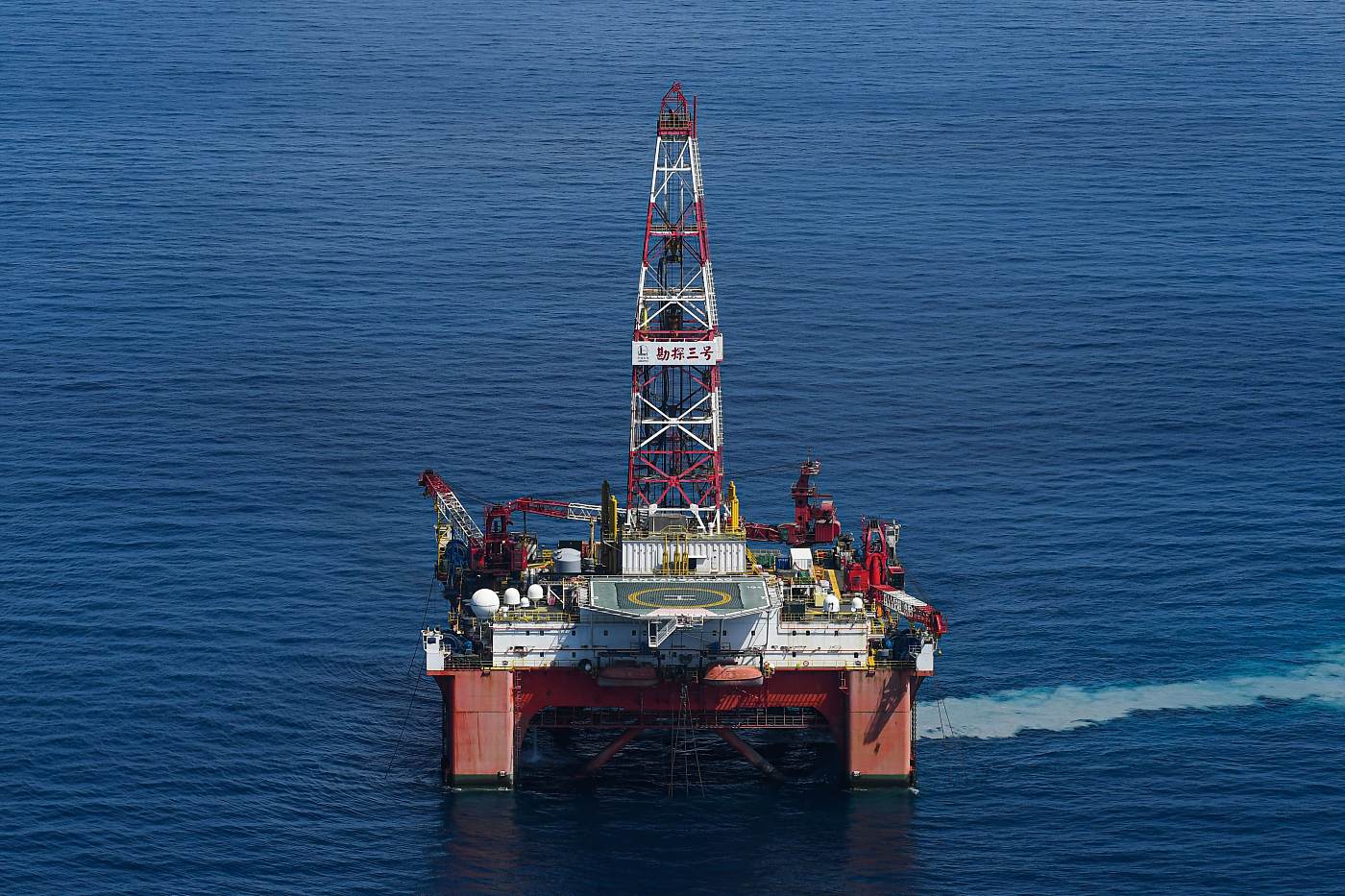
In 2014, China deployed the $1 billion Haiyang Shiyou-981 rig in waters Vietnam called its EEZ, triggering a coast guard standoff near the Paracels. Vietnam stopped Repsol drilling in Block 136-03 in 2017 and Red Emperor-related drilling in 2018 after Chinese threats or pressure.
In 2019, Haiyang Dizhi 8 left Vietnam's EEZ after a four-month standoff linked to Rosneft's Hakuryu 5 rig in Block 06-01. These episodes suggest that offshore energy work can become a gray-zone confrontation involving survey ships, coast guard escorts and political pressure before any naval battle occurs.
Malaysia, Taiwan and the Wider Resource Map
Chinese coast guard ships operate in waters claimed by Malaysia nearly every day while Malaysia expands oil and gas exploration. Malaysian officials have continued offshore activity even as Chinese patrols near Luconia Shoals and other blocks increase the operating risk for commercial energy firms.
In 2025, Taiwan's government accused China of violating international law by conducting oil and gas exploration within waters that Taiwan considers part of its EEZ and called on Beijing to "clearly explain" its actions and immediately stop the activity.
"This not only violates international legal norms such as the United Nations Convention on the Law of the Sea (UNCLOS), but also seriously undermines the international order and poses uncertain risks to regional stability," Taiwan's presidential office spokesperson, Karen Kuo, said.
US and Allied Response
Washington has no direct sovereignty claims or unique maritime rights in the South China Sea. It frames its involvement around freedom of navigation, lawful maritime claims, alliance commitments and opposition to coercive changes to the status quo.
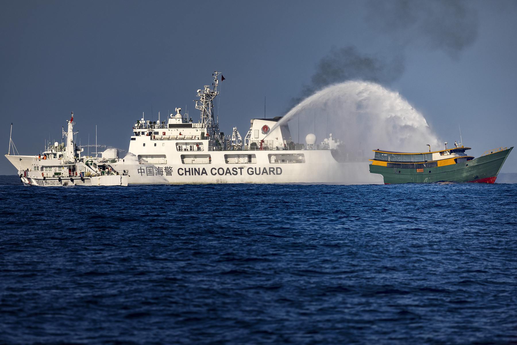
This allows the U.S. to challenge what it calls excessive maritime claims without formally choosing among competing sovereignty claims over rocks, reefs and islands. For instance, a confrontation at Second Thomas Shoal on July 20, 2026, reportedly involved Chinese Coast Guard personnel and Philippine forces.
Following the confrontation, Philippine fishing vessels allegedly faced harassment from Chinese Coast Guard ships seeking to restrict their activities near Scarborough Shoal. Philippine maritime authorities subsequently released footage showing Chinese vessels using water cannons and conducting what Manila described as dangerous maneuvers around the Filipino vessels.
"We're committed to supporting our treaty partners, and obviously we've already done quite a bit. In fact, there was a U.S. Coast Guard vessel in the region at the time that this happened and actually helped stand between the two sides and allowed the individual who was injured to be rescued and brought back for medical treatment," U.S. Secretary of State Marco Rubio said in response to the incident.
Freedom of Navigation Operations
U.S. Freedom of Navigation Operations challenge maritime claims deemed excessive under international law, and since October 2015, several operations have challenged Chinese claims in the South China Sea. In 2017, U.S. Pacific Command requested approval for a warship to sail within 12 nautical miles of Scarborough Shoal, a feature claimed by China and the Philippines.
In May 2024, U.S. Navy Destroyer USS Halsey (DDG 97) asserted navigational rights and freedoms in the South China Sea near the Paracel Islands. According to the U.S. Navy, this freedom of navigation operation "upheld the rights, freedoms, and lawful uses of the sea recognized in international law by challenging the restrictions on innocent passage imposed by the People's Republic of China (PRC), Taiwan, and Vietnam and also by challenging the PRC's claim to straight baselines enclosing the Paracel Islands."
The Philippines Treaty Question
In 2019, then U.S. Secretary of State Mike Pompeo said attacks on Philippine forces, aircraft or public vessels in the South China Sea would trigger Article IV of the U.S.-Philippines Mutual Defense Treaty. In May 2023, Manila and Washington issued bilateral defense guidelines clarifying obligations for attacks in disputed waters or on Philippine government vessels, including coast guard vessels.
In early February 2023, President Ferdinand Marcos Jr. agreed to allow an expanded U.S. military presence in the Philippines, a move supporters describe as deterrence and critics describe as renewed militarization of a historically sensitive alliance. On April 11, 2024, then U.S. President Joe Biden reaffirmed U.S. defense commitments to Japan and the Philippines at a Washington summit.
In 2025, the Trump administration promised "ironclad" support for the Philippines' security against Beijing's "dangerous and destabilizing" activity in the region. Separately, the State Department said in a statement that "Secretary Rubio conveyed that [China's] behavior undermines regional peace and stability and is inconsistent with international law," adding that "An armed attack in the Pacific, including anywhere in the South China Sea, on either of their public vessels, aircraft, or armed forces – which includes their Coast Guards – would invoke mutual defense commitments."
In July 2026, the Philippines, Japan and the U.S. completed their latest round of joint defense exercises in the South China Sea. The exercises "underscore the enduring partnership among the partner nations in promoting peace, stability, and security in the Indo-Pacific region," the Armed Forces of the Philippines said in a statement.
In response, China said Beijing and Singapore would conduct the "Maritime Cooperation-2026" joint naval exercise in the waters and airspace near Zhanjiang, Guangdong Province, which were held in early September 2026. The drills featured live-fire exercises, underway replenishment and joint search-and-rescue operations, aiming to "enhance mutual trust between the two sides, promote practical cooperation and strengthen their ability to jointly safeguard regional peace and stability."
Allies, Minilaterals and Restraint Debates
In 2021, the U.S., U.K. and Australia established AUKUS as a trilateral security partnership. At its core, the partnership — worth $239 billion (A$368 billion) over 30 years — was believed to counter China's role in rising tensions in disputed territories such as the South China Sea.
China condemned the agreement as "extremely irresponsible." Supporters described it as a long-term Indo-Pacific deterrence project, while critics argued that the partnership risked tying Australia more closely to a future U.S.-China conflict.
At the 2022 Quad Leaders' Summit in Tokyo, the members launched the Indo-Pacific Partnership for Maritime Domain Awareness (IPMDA), an initiative designed to strengthen and expand existing maritime domain awareness capabilities across the Indo-Pacific region.
In 2026, the United States and allies, including Australia, Japan, the Philippines and the U.K., marked the 10th anniversary of the 2016 arbitral award, showing that allied diplomacy increasingly links maritime law with the broader Indo-Pacific security architecture.
Diplomacy and Outlook
Diplomacy in the South China Sea faces persistent challenges as ASEAN and China negotiate a binding Code of Conduct amid disputes over legal force, geographic scope and enforcement.
ASEAN issued its first South China Sea statement in 1992, endorsed a Code of Conduct in 1996 and signed a non-binding Declaration on the Conduct of Parties with China in 2002. ASEAN-China Code of Conduct (COC) talks began in 2014, and on Aug. 3, 2018, the parties announced a 19-page single draft negotiating text as the basis for a code. The draft repeated that the code would not settle territorial disputes or maritime delimitation, meaning it was designed as a crisis-management instrument rather than a sovereignty settlement.
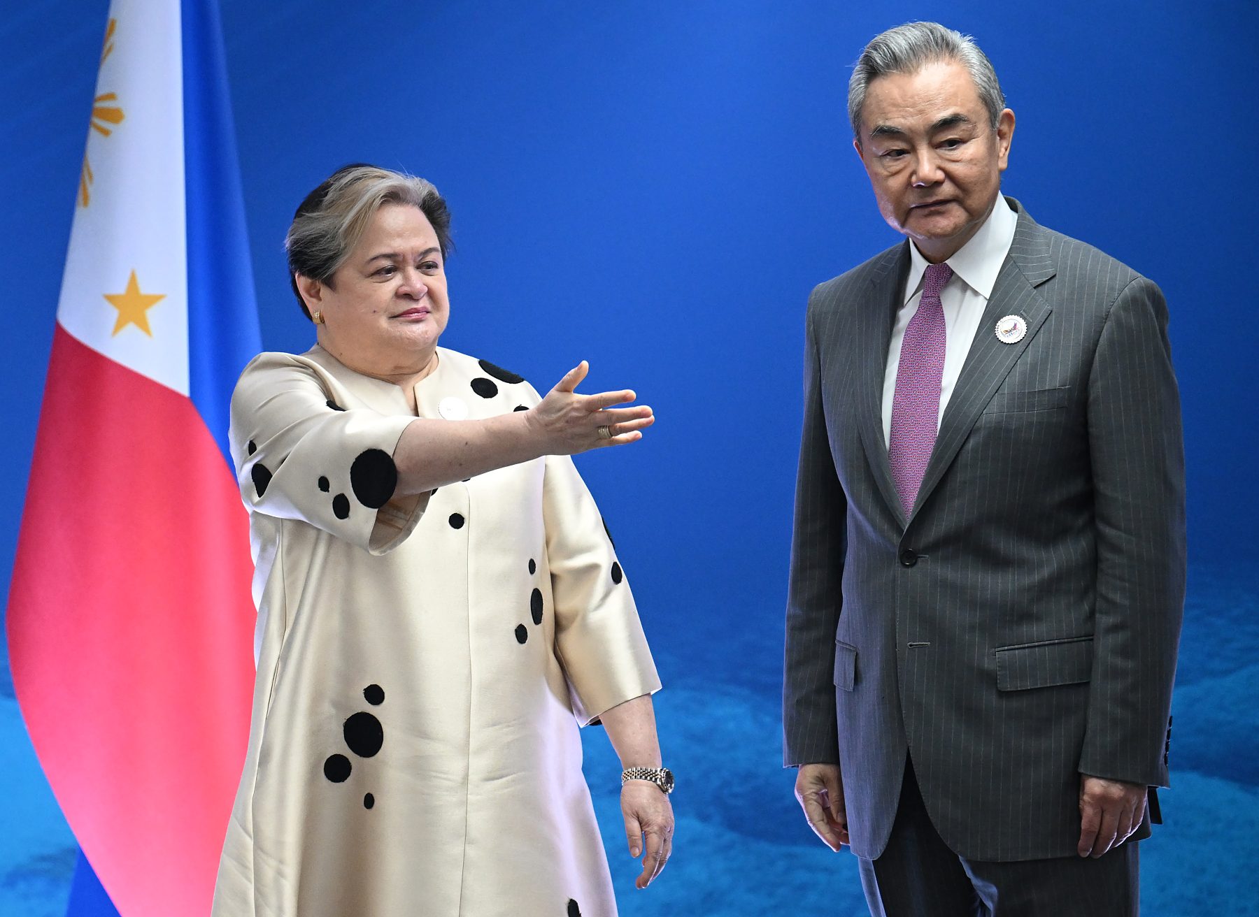
At a press conference following the China-ASEAN foreign ministers' meeting, State Councilor and Foreign Minister Wang Yi said the key achievement was the relationship's transition from growth to maturity, ushering in a new phase of comprehensive development. Wang stated that "We will share opportunities and face challenges together so as to build a closer community with [a] shared future."
Stalled Consensus
On July 13, 2023, China and ASEAN countries agreed on guidelines to accelerate talks on a binding COC, with a three-year deadline. Successive ASEAN chairs, including Indonesia in 2023 and Laos in 2024, advanced efforts to conclude a South China Sea COC by 2026. However, negotiations remain constrained by disagreements over the agreement's legal force, coverage of disputed features and exclusive economic zones, restrictions on third-party activities and its relationship with UNCLOS and the 2016 arbitral ruling.
On Jan. 8, 2025, the Philippines said ASEAN and China should tackle COC scope and legal force as milestone issues. ISEAS reported in 2025 that China preferred a flexible non-binding COC, while some ASEAN states sought a robust, legally grounded agreement. Disagreements over geographic scope, binding force, enforcement, dispute-settlement language and the role of external military actors have repeatedly slowed progress.
Manila's Chairmanship and ASEAN Limits
On Jan. 22, 2026, Secretary of Foreign Affairs of the Republic of the Philippines, Ma. Theresa Lazaro, said the Philippines, as ASEAN chair, would insist the COC explicitly reference UNCLOS. ASEAN and China targeted a year-end COC conclusion after monthly meetings began in January, and Lazaro proposed talks as often as weekly.
Philippine and regional analysts cautioned that negotiation fatigue and unresolved legal issues could produce only a broad and symbolic consensus. ASEAN statements in 2016 and in the 2026 foreign ministers communiqué omitted the 2016 arbitral ruling on China's South China Sea claims, showing the constraints of consensus language.
Escalation Risks and De-escalation Paths
In 2023, President Ferdinand Marcos Jr. said Manila was negotiating its own South China Sea COC with ASEAN claimant states such as Vietnam, stating, "We are now in the midst of negotiating our own code of conduct, for example, with Vietnam because we are still waiting for the code of conduct between China and ASEAN and the progress has been rather slow unfortunately." This points to a possible narrower claimant-led track if ASEAN-China talks remain stalled.
Incidents like the Second Thomas Shoal create a practical need for hotline use, rules for coast guard encounters, notification procedures, fisheries management and restraint around resupply missions. On July 21, 2026, China's Foreign Ministry reiterated that it would allow humanitarian resupply missions if the Philippines provided prior notification, while warning that it would "resolutely stop" any attempts to construct fixed facilities or establish a permanent outpost.
Overview


